Hiking & Nature in Paraty: Trails, Parks & the Atlantic Forest
The colonial Gold Trail, the Serra da Bocaina National Park, the wild Juatinga reserve and the climb to the Sugarloaf of the Mamanguá — a complete guide to walking one of the planet's richest forests.
Most people come to Paraty for the cobblestones and the boats. They should. But the town sits on the edge of something bigger and wilder, and you can feel it the moment you turn off the main square: the green wall behind the rooftops isn't decoration. It's the Atlantic Forest, one of the most biodiverse places left on earth, and it runs from the tideline up into cloud at 2,000 meters. More than 80% of the Paraty municipality is protected land. That means a short drive or a short boat ride puts you on trails that range from a flat hour-long history walk to a four-day crossing through fishing villages reachable only on foot.
This guide is the honest version. It covers what's worth your time, what each trail actually demands, who you need with you, and when to go. Some of these walks you can do in sneakers before lunch. One of them is a serious multi-day trek that people underestimate and regret. I'll be clear about which is which.
In this guide
The Atlantic Forest
Start with the forest itself, because everything else here is a footpath through it. The Mata Atlântica — the Atlantic Forest — is the band of rainforest that once ran almost continuously down Brazil's coast, from the northeast into Argentina and Paraguay. It is not the Amazon. It's older as a human landscape, far more fragmented, and in some ways more remarkable. Scientists count it among a small handful of global biodiversity hotspots: more than 16,000 plant species, over 2,400 vertebrate species, and an enormous share of them found nowhere else on the planet. A single hillside here can hold more tree species than all of North America.
The hard part of the story is what's left. Centuries of logging, sugar, coffee, cattle, and city-building have reduced the Atlantic Forest to a conservative 7 to 12% of its original extent, and most of that survives in scattered patches. Which is exactly why the stretch around Paraty matters so much. This is one of the largest continuous tracts that remains, knitted together by a national park, a state reserve, and the buffer of protected coast. UNESCO recognized it in 2019, listing "Paraty and Ilha Grande – Culture and Biodiversity" as Brazil's first mixed World Heritage site — culture and nature in the same inscription. That's rare, and it's earned.
What does it actually feel like to walk in? Dense, layered, and loud in a good way. The canopy closes overhead so the light comes down green and broken. Tree trunks disappear under bromeliads, orchids, ferns, and vines; everything is growing on everything else. The air is warm and wet and smells like leaf litter and flowers you can't name. You'll hear water you can't see, insects in waves, and birds calling back and forth across the valley. It is humid — this is one of the rainiest stretches of the Brazilian coast — so expect to sweat, expect the trail to be muddy in places, and expect to be glad of it, because that constant moisture is what makes the forest this thick.
The structure repays a slow look. There isn't one forest here but several stacked on top of each other, and you climb through them as you gain altitude. Down near sea level you're in lowland coastal rainforest — broad-leaved, tangled, hot. Push up the slopes and the trees change, the air cools, and on the highest ridges of the interior you reach montane and cloud forest, where mist hangs in the canopy for much of the day and a whole different cast of plants takes over. That vertical stacking, packed into a short horizontal distance because the mountains rise so steeply off the coast, is one of the engines of the region's diversity. Two slopes facing different directions can hold noticeably different forests.
It's also worth understanding why so much survives right here when so little survives elsewhere. The Atlantic Forest got cleared first and hardest precisely because it's where the colonists landed and where the cities grew. What spared the Paraty stretch was, ironically, isolation: the mountains came down so abruptly to the sea that for centuries the only good way through was by boat, and large-scale farming never took hold the way it did on flatter coast. When the modern coastal highway finally punched through in the 1970s it opened the area to tourism, but by then much of the forest was already wrapped in protection. The result is the rare thing you're standing in — a big, continuous, living piece of a forest that's mostly gone.
One practical note before you go anywhere: this is protected land, and a lot of it is genuinely remote. The good trails aren't all signposted, some cross private property, and a few cross terrain where a wrong turn means real trouble. Pair that with the heat and the rain and you have a place that rewards a little planning. The rest of this guide breaks the options down from easiest to most demanding so you can match a trail to your day, your fitness, and your patience for mud.
The Caminho do Ouro (Gold Trail)
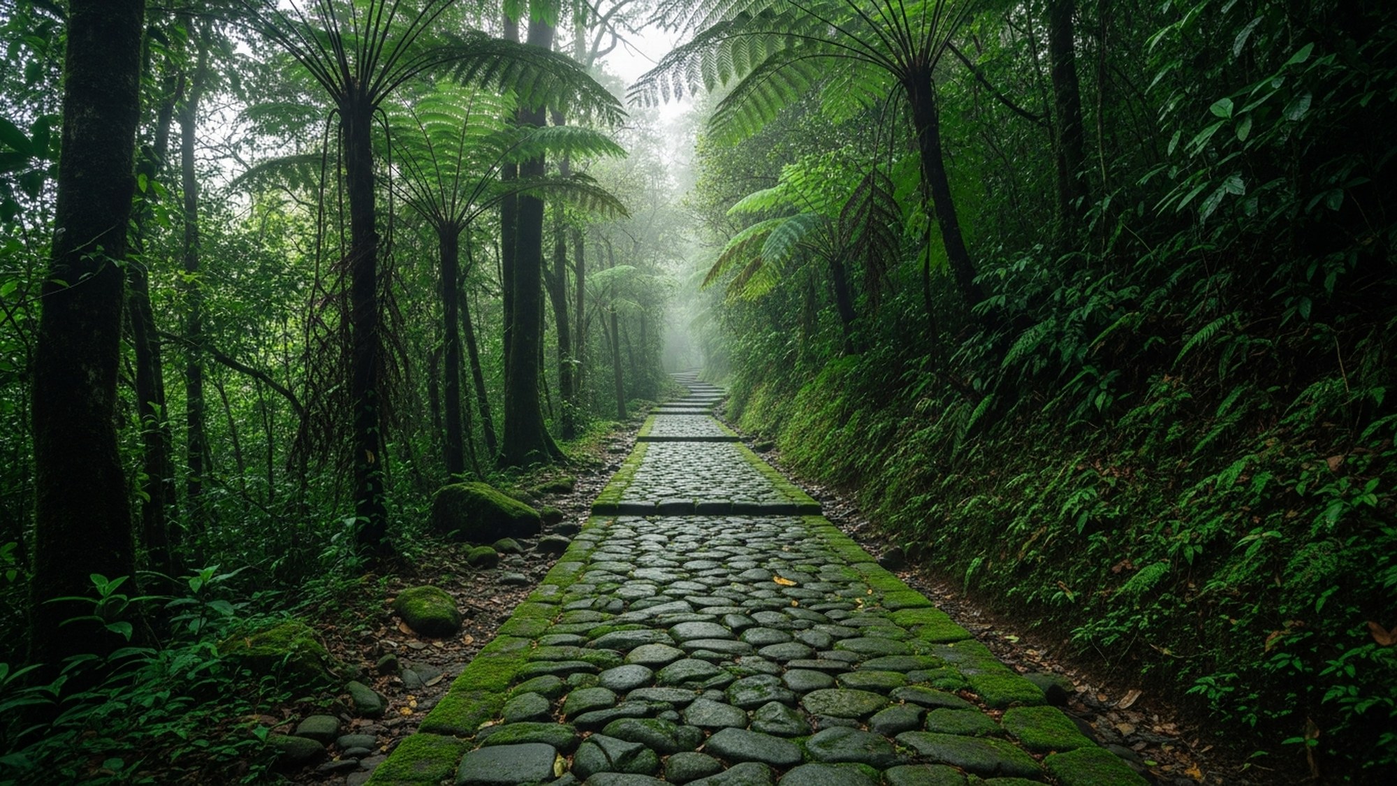
If you do one walk in Paraty, make it this one. The Caminho do Ouro — the Gold Trail — is a guided hike along a preserved section of the original colonial road that carried Brazil's gold from the mines down to the sea. It's the easiest serious thing you can do here: roughly 1.5 to 2 hours at a relaxed pace, easy to moderate, and it doubles as the best history lesson in town.
Here's the setup. You meet at the CIT — the visitor center for the Caminho do Ouro — in the Penha neighborhood, on the road that climbs toward Cunha. From there an authorized guide is required; this isn't a formality you can skip. The trail crosses private land, the guide holds the access, and frankly you'd miss most of what makes the walk interesting without one. They unlock the route, read the forest, and tell you what you're looking at.
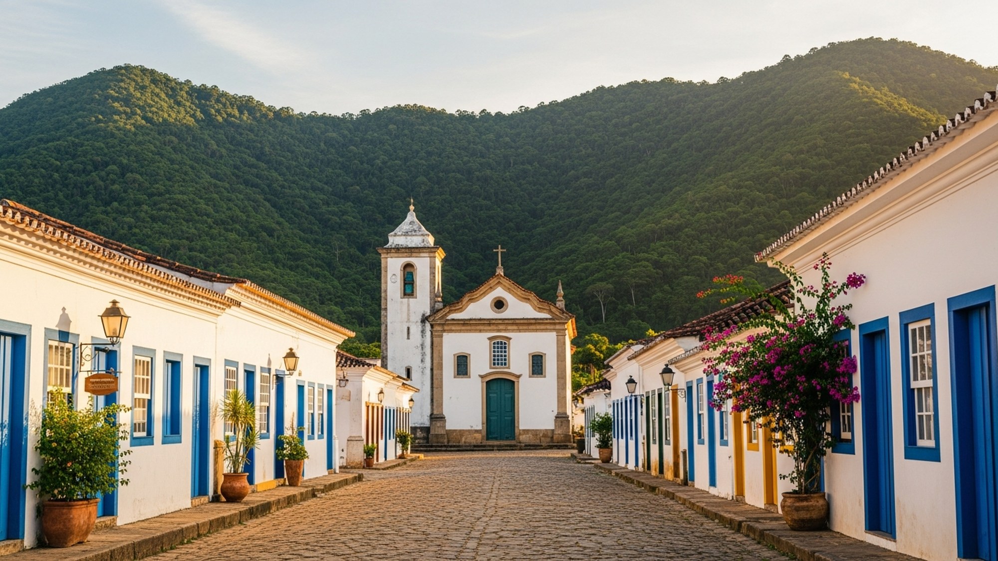
And what you're looking at is the road itself. In the 17th and 18th centuries, when gold was found inland in Minas Gerais, the crown needed a way to move it to the coast and onto ships bound for Lisbon. The answer was a stone-paved mountain road, and Paraty became its Atlantic port — for a stretch, one of the busiest in the colony. The paving you walk on was laid by hand by enslaved Africans, large fitted stones hauled and set across steep, wet terrain. Centuries later the stones are still here, mossed over and uneven, dipping into the forest. It's a beautiful walk and an uncomfortable history at the same time, and a good guide holds both of those truths without flinching.
It helps to picture the traffic this road once carried. Mule trains came down out of the mountains loaded with gold, and went back up loaded with everything the mining settlements couldn't make for themselves — salt, tools, cloth, and enslaved people forced inland to work the mines. Paraty grew rich on being the hinge in that exchange. The grand colonial houses and churches in the old town, the wealth that made the place worth preserving, all of it traces back to this stone path through the forest. The boom didn't last; when a more direct road to Rio opened in the 1700s and the gold itself ran thin, Paraty slid into a long quiet that, in hindsight, is exactly why the town survived intact instead of being modernized away. The road you walk is the reason the town exists and the reason it was forgotten.
Physically, none of this is hard. You're mostly walking, with a few short climbs and the occasional careful step over a worn stone or a tree root crossing the path. The forest is shaded, which takes the edge off the heat, and the pace is conversational. What the walk asks of you isn't fitness; it's attention. The story sits in details you'd miss alone — the tool marks on a stone, the line where the original paving meets a later repair, the way the road was engineered to shed water on a slope that gets drenched half the year.
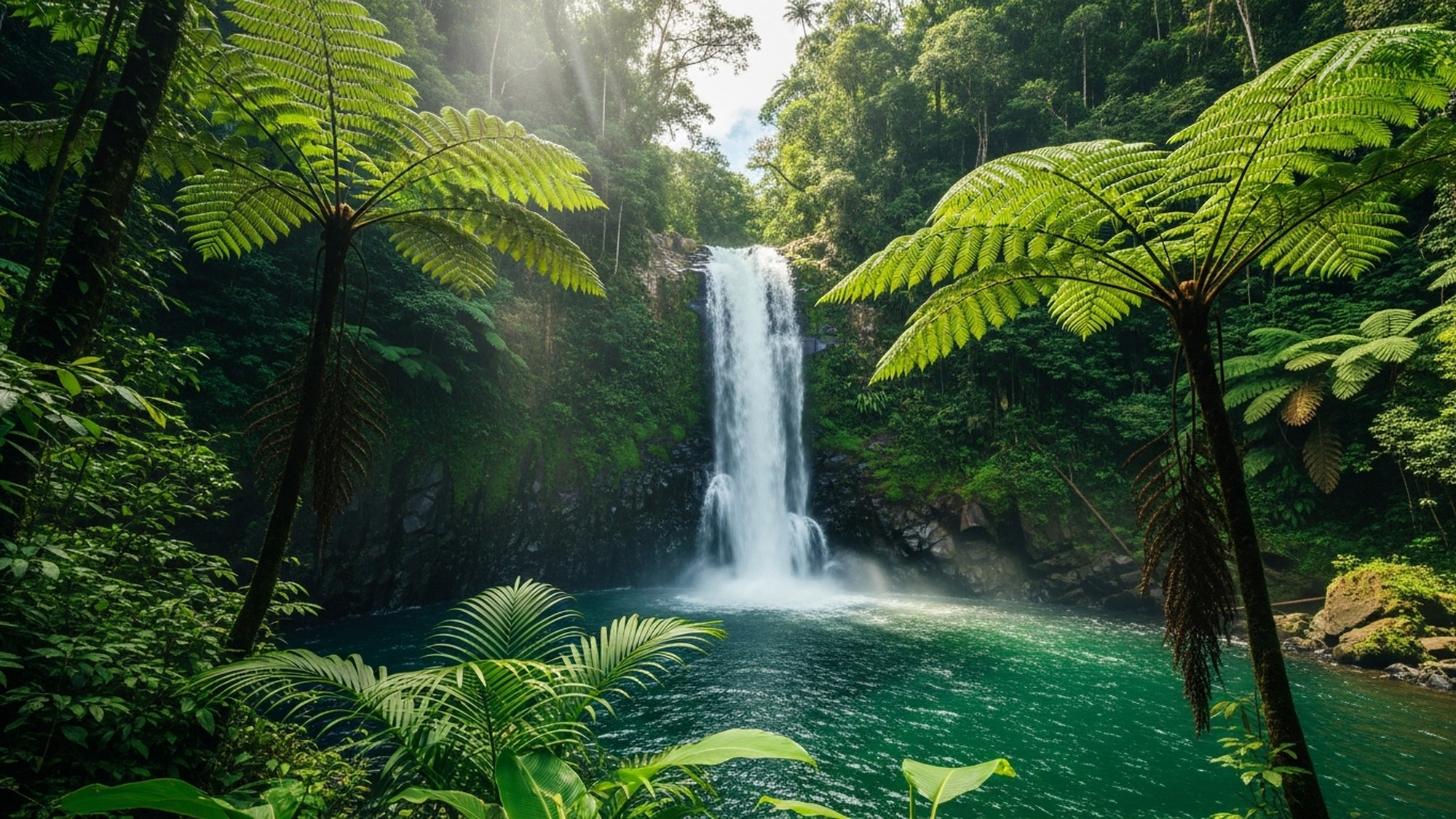
The route also delivers on scenery. The path threads through tall second-growth and older forest, past small streams, and the standard guided walk includes a waterfall where you can cool off, plus a stop at a working cachaça distillery — Paraty's sugarcane spirit. The tasting is a fitting endnote: the same gold economy that built this road also made Paraty a famous cachaça town. For a couple of centuries the word "parati" was practically shorthand for a good pour. (It was a synonym for quality cachaça, not the place the drink was invented — the spirit was made all over colonial Brazil; Paraty's was just renowned.) These days the region holds both an official Geographic Indication and a Denomination of Origin from Brazil's patent office, the only cachaça region with both. If you want the deep version of that story, our guide to Paraty goes into the distilleries.
Good to know
- Meet: the CIT (visitor center) in Penha, on the Paraty–Cunha road.
- Guide: required — the trail crosses private land and access runs through authorized guides.
- Effort: easy to moderate, around 1.5–2 hours, some uneven stone and short climbs.
- Includes: the colonial paving, forest, a waterfall stop, and a distillery tasting.
- Wear: sturdy closed shoes with grip — the old stones get slick.
Don't confuse this short, civilized walk with the trek of nearly the same name in the next section. That's a common and expensive mistake.
Serra da Bocaina & the long Trilha do Ouro
Behind Paraty the land climbs fast, and at the top of the climb is Parque Nacional da Serra da Bocaina, a national park managed by Brazil's federal conservation agency, ICMBio. It's big — on the order of 106,000 hectares — and it straddles the border between Rio de Janeiro and São Paulo states. What makes it special is the vertical range. The park drops from peaks around 2,000 meters down to the coast near Trindade, which means in a single protected area you pass through high-altitude grasslands and cloud forest at the top and dense coastal rainforest at the bottom. That gradient is a big part of why the biodiversity here is so high.
The headline route inside the park is the Trilha do Ouro — also a "gold trail," and this is where people get tripped up. This is not the gentle two-hour walk you do from Penha. The Trilha do Ouro in Serra da Bocaina is a serious multi-day trek: roughly 56 kilometers over about three days, starting up high at São José do Barreiro on the São Paulo side and descending all the way to Mambucaba on the Rio coast. It follows another stretch of historic gold road but at a completely different scale — a long, committing descent through the park's full range of ecosystems, past a chain of waterfalls, sleeping rough or in basic shelters along the way.
Same name, same history, wildly different trip. The Penha walk is an afternoon. The Bocaina crossing is three days of real trekking — go in prepared, with a guide who knows the route.
If you're a fit, experienced hiker and you want the genuine article, the Bocaina Trilha do Ouro is one of the great treks in southeast Brazil. But treat it accordingly: you need a competent guide, you need to be honest about your fitness, and you need to plan logistics around the weather, because long descents on this terrain turn dangerous after heavy rain. Day-trippers should stick to the Penha walk. There's no shame in that — it's a fine walk — but the two are not interchangeable, and confusing them at the trailhead is how people end up overcommitted.
Worth knowing: the park's coastal edge near Trindade is also the gateway to some of the area's best beaches and the famous natural pool at Cachadaço, which you can reach on a much shorter trail. That's a separate kind of day out — more swimming than summiting — and we cover it in our boat, islands and beaches guide.
The Juatinga Reserve
South of Paraty, a long finger of land pushes out into the sea: the Ponta da Juatinga peninsula. Most of it is the Reserva Ecológica Estadual da Juatinga, and the first thing to get straight is what kind of protected area this is. It's a state ecological reserve, managed by Rio de Janeiro's state environment institute (INEA) — not a national park, and not run by the federal ICMBio that handles Bocaina. It covers about 9,797 hectares of coastal forest, beaches, and headland.
The reason that distinction matters isn't bureaucratic — it shapes who lives there and how you visit. Juatinga is home to caiçara communities: the traditional coastal people of southeastern Brazil, descended from a mix of Indigenous, Portuguese, and African roots, who have fished and farmed these shores for generations. The reserve was created in part to protect their way of life alongside the forest. So when you walk here you're not passing through empty wilderness; you're passing through people's home — small fishing settlements tucked into the bays, dugout canoes pulled up on the sand, manioc patches behind the houses. Treat it that way. Buy a meal, ask before you photograph anyone, and remember you're a guest.
The classic way to experience Juatinga is the Travessia da Juatinga, a coastal crossing that links a string of beaches and villages around the peninsula. It's a multi-day affair — figure anywhere from 4 to 7 days depending on the route you pick and the pace you keep — and it moves on foot and by boat only. There are no roads into the heart of it. Infrastructure is minimal by design: you sleep in simple guesthouses or camp, you eat what the communities cook, and you arrange boat hops between sections that can't be walked. It is one of the most rewarding things you can do in this part of Brazil and also one of the least forgiving of poor planning. Tides, surf, and weather dictate which beaches are passable on a given day, and that's local knowledge you can't get from a map.
Good to know — Juatinga
- What it is: a state ecological reserve (INEA), ~9,797 ha — not a national park.
- Who's there: traditional caiçara fishing communities; visit respectfully.
- The crossing: the Travessia da Juatinga, roughly 4–7 days, on foot and by boat.
- Access: no roads in; minimal infrastructure; a local guide is effectively essential.
- Casual option: many visitors do a day or overnight to a single beach (Praia do Sono is a popular gateway) rather than the full traverse.
If a week-long expedition isn't your trip, you don't have to skip Juatinga entirely. Plenty of people sample its edge — a boat or a short hike out to one stunning beach, a night in a community guesthouse, then back. Praia do Sono is the usual entry point and gives you a real taste of the peninsula without the full commitment. The concierge at the house can line up a guide and a boat for either the day version or the long crossing, which spares you the hardest part: figuring out the logistics from scratch.
Saco do Mamanguá & the Pico
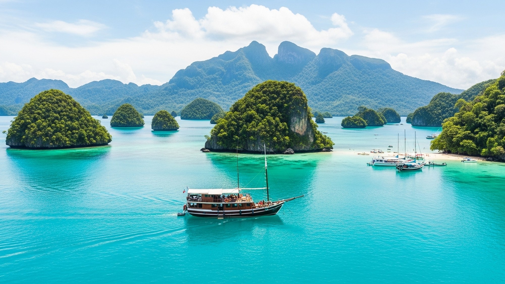
Of all the landscapes around Paraty, the Saco do Mamanguá is the one that makes people stop and stare. It's a long, narrow, sheltered bay — roughly 8 kilometers deep — that cuts back into the coast between two forested ridges, with mangroves at its head and calm shallow water the whole way in. You'll see it described everywhere as "the only tropical fjord in Brazil," and the shape does invite the comparison: steep green walls dropping straight into still water.
But let's be accurate, because it's a nice piece of geology. A fjord is carved by a glacier. The Saco do Mamanguá was never glaciated — it's a ria, a river valley that drowned when sea levels rose and flooded the lowland between the ridges. So "tropical fjord" is a great nickname and a useful one for picturing the place, but technically it's a ria. Knowing the difference won't change how stunning it is; it'll just make you the most interesting person on the boat.
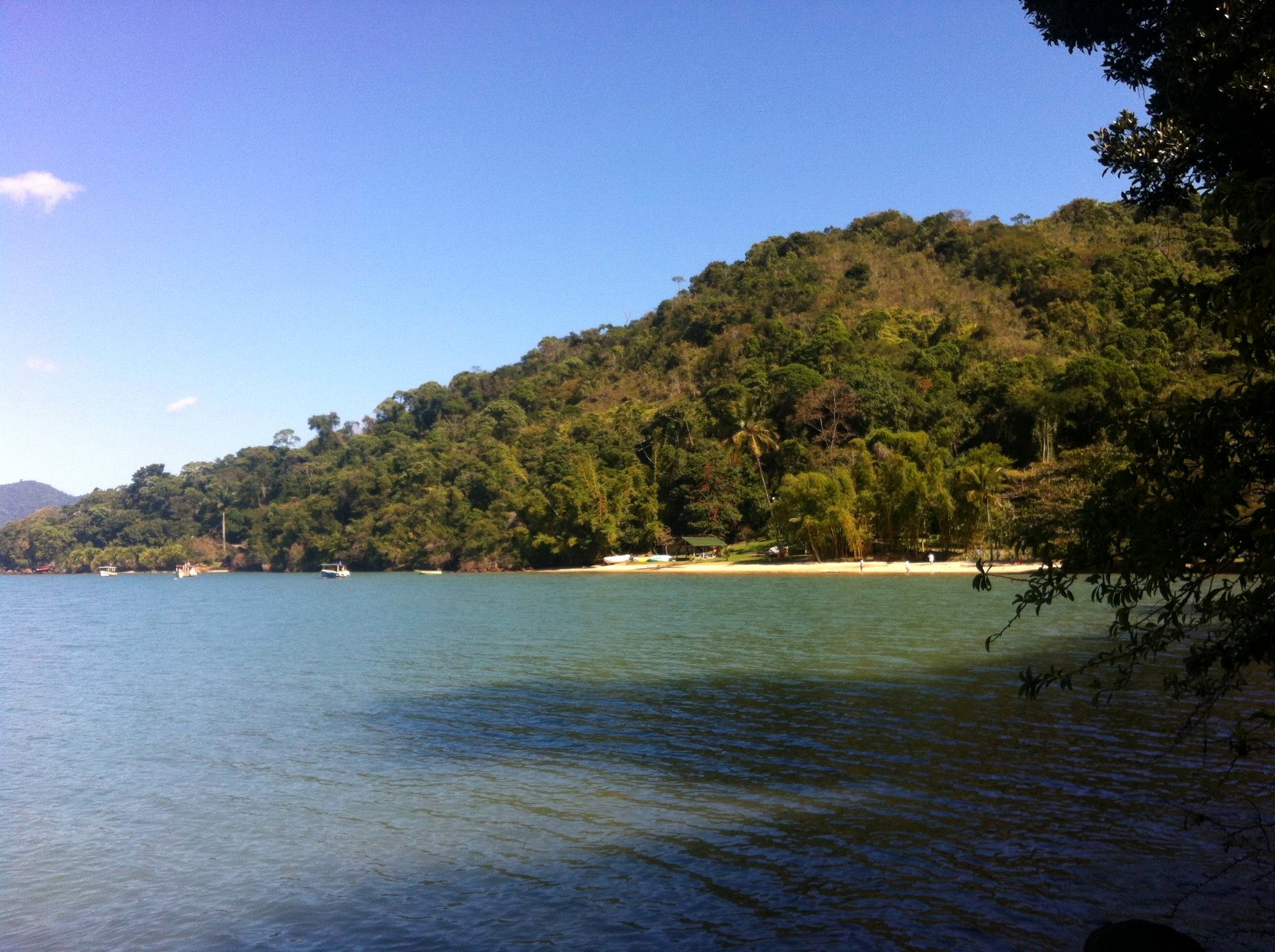
The bay is worth a slow day on the water by itself — calm enough to paddle, dotted with small beaches and the mangroves that nurse the whole ecosystem. But the reason hikers come is the view from the top, and you get it from the Pico do Pão de Açúcar do Mamanguá — the "Sugarloaf of Mamanguá." This is the standout summit hike in the Paraty area and it earns the effort.
Here's the honest brief. The trail starts at Praia do Cruzeiro, near the head of the bay, which most people reach by boat. From there it's short but steep: about 1.5 to 1.7 kilometers one way, climbing to a summit around 425 meters. Don't let the short distance fool you — it's a real climb, and it usually takes around 45 minutes to an hour or more depending on conditions and how often you stop to breathe. The steepest sections have fixed ropes to help you up and over the rock, and you'll use them. After rain the route gets slick and the ropes become genuinely necessary rather than optional.
What you get at the top is the payoff for all of it: a top-down view over the entire inlet, the long blue finger of the bay stretching out below you between two ridgelines, beaches and mangroves laid out like a map, the open sea beyond. It's one of the best vantage points on the whole Costa Verde. Most people time it for the golden light of late afternoon or, if they're committed, an early start for sunrise. Either way, give yourself margin and don't get caught on the ropes in the dark.
A couple of practical realities about the Mamanguá day. Because the trailhead is most easily reached by boat, the hike usually comes bundled with time on the water — paddle into the bay, land at Cruzeiro, climb, come down, swim. That makes it a fuller day than the distance suggests, and the boat schedule, not the trail, often decides your timing. The bay itself is shallow and protected, which is why it's so good for kayaking and stand-up paddling; the mangroves at its head are a nursery for fish and crab and a serious piece of the local ecology, so they're off-limits to trampling. If you only have energy for one summit in the Paraty area, this is the one to spend it on. The Pico delivers a view you simply can't get any other way, and the climb is short enough that you'll be back in the water by lunch.
Good to know — Pico do Mamanguá
- Trailhead: Praia do Cruzeiro, usually reached by boat into the bay.
- The climb: ~1.5–1.7 km one way to a ~425 m summit; moderate to hard, steep.
- Time: around 45 min to over an hour up; budget more if it's wet or crowded.
- Ropes: fixed ropes on the steep rock — fine in the dry, important after rain.
- Best light: late afternoon or sunrise; carry a headlamp if you cut it close.
What you'll see and hear
Let me set expectations honestly: the Atlantic Forest is spectacularly biodiverse, but biodiverse rainforest is not a zoo. The wildlife is there in extraordinary variety — it's just shy, mostly small, and often heard before it's seen. If you walk in expecting a parade of charismatic animals, you'll be disappointed. If you walk in paying attention, you'll come out grinning.
Birds are the easiest win. This forest is one of the richest bird habitats on the continent, and even a casual walker will notice tanagers in absurd colors, toucans clattering through the canopy, hummingbirds working the flowers, and woodcreepers spiraling up trunks. Bring binoculars if you have them — they change the whole experience. The single best wildlife moment isn't a sighting at all, it's the dawn chorus: if you're on the trail or even just awake near the forest at first light, the birds all start at once and the volume is genuinely startling. It's the forest's best trick and it's free.
For mammals, think monkeys. You've got a decent chance of hearing or glimpsing them in the trees — small primates moving through the canopy, sometimes a troop crossing overhead. Howlers announce themselves from a distance with a sound like wind through a tunnel; you'll likely hear them before you have any hope of seeing them. Beyond that there are agoutis, coatis, and a long list of creatures you almost certainly won't see — this forest holds rare and endangered species precisely because they're elusive. Then there are the constants: butterflies in real numbers, lizards on warm rocks, frogs you hear all night, and after dark, fireflies.
The plants are wildlife too, and they're the part most people overlook. Bromeliads grow in the crooks of branches and collect little reservoirs of water that become entire ecosystems — frogs breed in them, insects live in them, dozens of feet off the ground. Orchids cling to bark. Strangler figs wrap and slowly kill their host trees, leaving hollow lattice columns. There are trees whose bark a guide will tell you was used for fever, others for rope, others you should not touch at all. None of this announces itself; you walk past it unless someone points it out, and then suddenly the forest is full of stories.
So go in with the right frame. No guide can guarantee you a monkey or a toucan; anyone who promises a specific animal is selling, not guiding. What a good guide guarantees is that you'll notice ten times more than you would alone — the bird you'd have walked past, the spider the size of your hand sitting still in plain sight, the medicinal tree, the track in the mud. The richness here is in the looking, and the best hours for it are the quiet ones: early morning and the last light of the day, when the heat eases and the forest gets busy.
Guides and safety
I'll be direct about guides, because in this region they're not an upsell — they're often the difference between a great day and a bad one. Several of the best routes (the Caminho do Ouro, much of Juatinga, the Bocaina trek) legally or practically require a guide, whether because the trail crosses private land, runs through traditional communities, or simply isn't marked. Even where you could technically go alone, a local guide reads weather and tides you can't, knows which beaches are passable today, spots the wildlife, and carries the context that turns a walk in the woods into something you remember. They're also your safety net if anything goes wrong somewhere with no phone signal.
Beyond a guide, the basics here are the basics of any tropical hike, and the heat makes them matter more than usual:
- Water. You will sweat more than you expect in this humidity. Carry more than you think you need, and don't count on refilling at a stream unless your guide says it's safe.
- Sun. Even under canopy the UV is strong, and any beach or summit section is fully exposed. Hat, sunscreen, reapply.
- Insects and ticks. Use repellent. Long, light layers help on overgrown trails. Check yourself for ticks afterward, especially after grassy or brushy stretches. This is also dengue country, so mosquito precautions do double duty.
- Footing. The colonial stones, the rope sections on the Pico, and any trail after rain are all slick. Closed shoes with real grip, not flip-flops.
- Leave no trace. Pack out everything you pack in. This is protected forest and, in Juatinga, someone's home — no litter, no picking plants, no feeding animals, no shortcutting switchbacks.
- Tell someone your plan. If you're going without a guide on a shorter trail, tell your host where you're headed and when you'll be back. Signal disappears fast out here.
Health, briefly
Yellow-fever vaccination is recommended for travel in Rio de Janeiro state, including the coast, and it needs about ten days to take effect, so sort it out before you fly. Dengue is present year-round, which is one more reason to use mosquito repellent. None of this should put you off — millions visit without incident — but check the current CDC travel advisory for Brazil for the up-to-date guidance rather than relying on a number in an article.
When to hike
Paraty is one of the rainiest places on the Brazilian coast, and there's no true dry season — it can rain any month. But there's a clear better window. The drier, cooler stretch from April to October is when you want to be on the trails. Days are pleasant rather than punishing (think low-to-mid 20s Celsius), there are fewer rainy days, and the ground is in better shape. The summer months from December to February are hot, very humid, and by far the wettest — January is the peak — which makes long hikes harder and trail conditions worse.
The sweet spots are the shoulder months: April–May and September–October. You get the good weather of the dry window without the winter-holiday crowds or the high-season prices, and the roads in are more reliable. That last point matters more than it sounds. The coastal highway into Paraty is curvy and prone to landslide closures in heavy rain, with December through March the worst stretch, so traveling in the drier months smooths the whole trip, not just the hiking.
Two timing notes whatever month you come. First, hike in the morning. It's cooler, the light is better, the wildlife is more active, and you leave yourself margin if anything runs long — afternoon storms build fast in the warm season. Second, respect the rain. After a real downpour, steep trails like the Pico's rope sections and the long Bocaina descent get dangerous, streams swell, and some Juatinga beaches become impassable. A good guide will simply rearrange the day, and you should let them. The forest isn't going anywhere.
For the bigger picture on seasons, road conditions, and getting in and out, our guide to getting to Paraty has the full rundown.
What to pack
You don't need expedition gear for the short walks, but a little preparation goes a long way in this heat and mud. Here's a practical kit that covers everything from the Penha walk to a Pico summit:
- Closed shoes with real grip — trail runners or light hiking shoes. Skip new boots; the trails are wet and your feet will be too.
- More water than feels necessary — at least a liter for short walks, two-plus for anything longer or steeper.
- Sun protection — hat, sunscreen, sunglasses. Reapply on exposed sections.
- Insect repellent — and reapply that too.
- A light rain layer — a packable shell. It can rain any day, and a brief shower is normal even in the dry season.
- Quick-dry clothing — you'll sweat through cotton and stay wet. Light long sleeves help on brushy trails and against sun and bugs.
- A dry bag or zip-lock — for your phone and valuables, essential on any trail with a boat transfer or a waterfall swim.
- Swimwear and a quick-dry towel — most of these walks pass water you'll want to get into.
- Snacks — fruit, nuts, something with salt for longer days.
- A headlamp — small and light; you'll want it for a sunrise or sunset summit.
- Cash in reais — for community meals, distillery tastings, boat fares, and guide fees; card coverage is patchy out of town.
- Binoculars — optional, but they transform the birdwatching.
For the multi-day routes (the Bocaina Trilha do Ouro, the full Juatinga crossing) you'll add camping or guesthouse logistics, more food, and proper navigation — but those are exactly the trips you shouldn't be doing without a guide, so let them advise on the specifics for the route and season you choose.
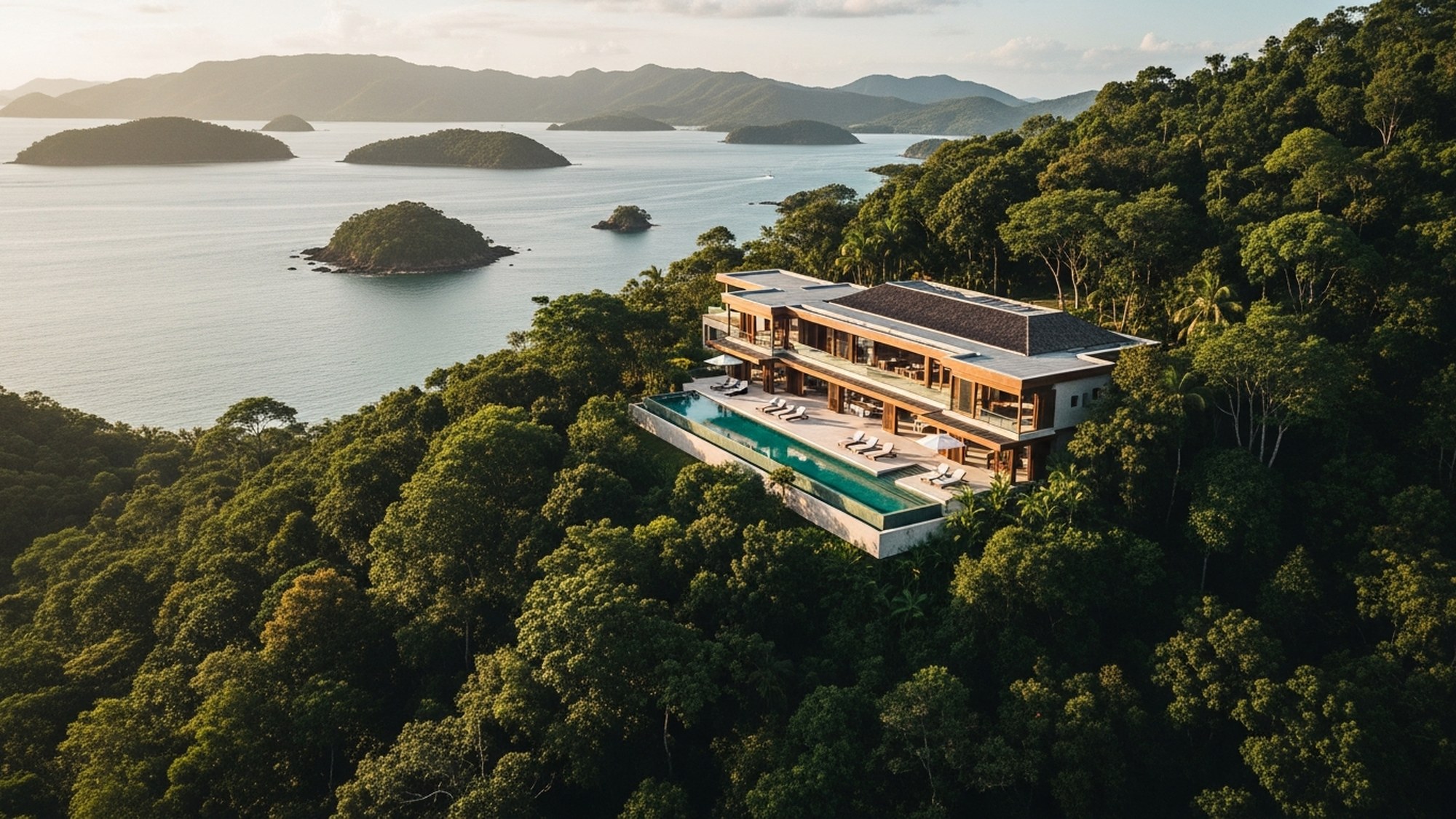
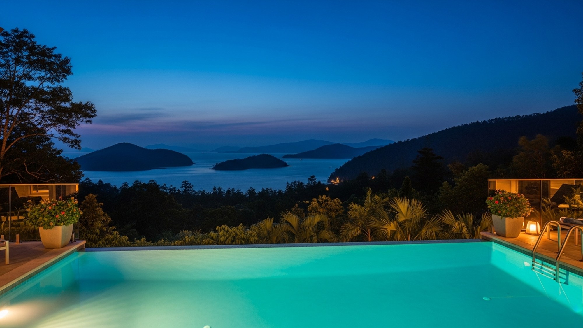
One last thing that's easy to overlook: where you base yourself shapes how much of this you actually do. Wake up already inside the forest, with the dawn chorus coming through the windows and a concierge who can have a guide and a boat arranged before breakfast, and the hard part — the logistics — mostly disappears. That's the quiet argument for staying somewhere like Amorielli rather than in the middle of town. The trails are the same; getting to them gets a lot easier.
Common questions
What's the easiest hike near Paraty?
The guided Caminho do Ouro from Penha. It's roughly 1.5 to 2 hours, easy to moderate, on the original colonial stone road, with a waterfall and a cachaça stop along the way. You need an authorized guide because it crosses private land, but it's the most accessible serious walk in the area and the best one for history.
What's the hardest, and how fit do I need to be?
The two big commitments are the Bocaina Trilha do Ouro (about 56 km over three days, descending from 2,000 m to the coast) and the full Travessia da Juatinga (4 to 7 days, on foot and by boat). Both demand real fitness, a guide, and careful planning around weather. For a tough but single-day option, the Pico do Pão de Açúcar do Mamanguá is short — about 1.5 km up — but steep, with rope sections and a roughly 425-meter summit. Most reasonably fit people manage the Pico; the multi-day treks are for experienced hikers.
Is the Saco do Mamanguá really a fjord?
It's often called the only tropical fjord in Brazil, and it certainly looks the part — a long, narrow, ridge-walled bay about 8 km deep. But geologically it's a ria: a river valley that flooded when sea levels rose, not a glacier-carved fjord. The nickname is a good way to picture it; the technically correct term is ria.
Do I have to hire a guide?
For several of the best routes, effectively yes — the Caminho do Ouro requires one by access, and Juatinga and the Bocaina trek require one in practice because of unmarked trails, private land, traditional communities, and conditions that change with the weather. Even where you could legally go alone, a local guide reads tides and storms, finds the wildlife, and is your safety margin where there's no phone signal. It's money well spent here.
When is the best time of year to hike?
April through October is the drier, cooler window and the better time for trails. The shoulder months — April–May and September–October — are the sweet spot: good weather, fewer crowds, lower prices, and more reliable roads. December to February is hot, very humid, and the wettest stretch, which makes hiking harder. Whatever month you come, start in the morning and respect the rain.
Will I see monkeys and toucans?
Maybe — and that's the honest answer. The forest is full of birds (the dawn chorus alone is worth waking up for) and you've got a fair chance of hearing or glimpsing monkeys in the canopy. But rainforest wildlife is shy and often heard before it's seen, and no honest guide will promise a specific animal. Bring binoculars, go slowly, pay attention, and you'll notice far more than you would on your own.
More from the Journal
The Complete Guide to Paraty, Brazil
Everything you need for the Costa Verde's most beautiful town: the UNESCO old town, the waterfalls and trails, the islands and beaches, the cachaça, where to eat and stay, when to come — and exactly how to get here.
The Waterfalls of Paraty: A Complete Guide
From the natural rock-slide of the Tobogã to the jungle pools of the Pedra Branca valley — where to find Paraty's waterfalls, how to reach them, how to stay safe, and the cachaça distilleries hidden among them.
Paraty by Boat: Islands, Beaches & Schooner Tours
Sixty-five islands, three hundred beaches and water the colour of glass. How to choose between the classic schooner and a private speedboat, the beaches worth the trail, and the day trip to Trindade's natural pool.
Stay at Amorielli.
A villa with an infinity pool, a private waterfall, and the kind of view people travel a long way to find. Join the waitlist to book the first season.