Saco do Mamanguá: Brazil's Tropical Fjord
An eight-kilometre arm of calm sea reaching into the mountains — often called Brazil's only tropical fjord. How to reach it, the stand-up paddling and kayaking, the oysters and caiçara communities, and the steep climb up the Pico do Pão de Açúcar.
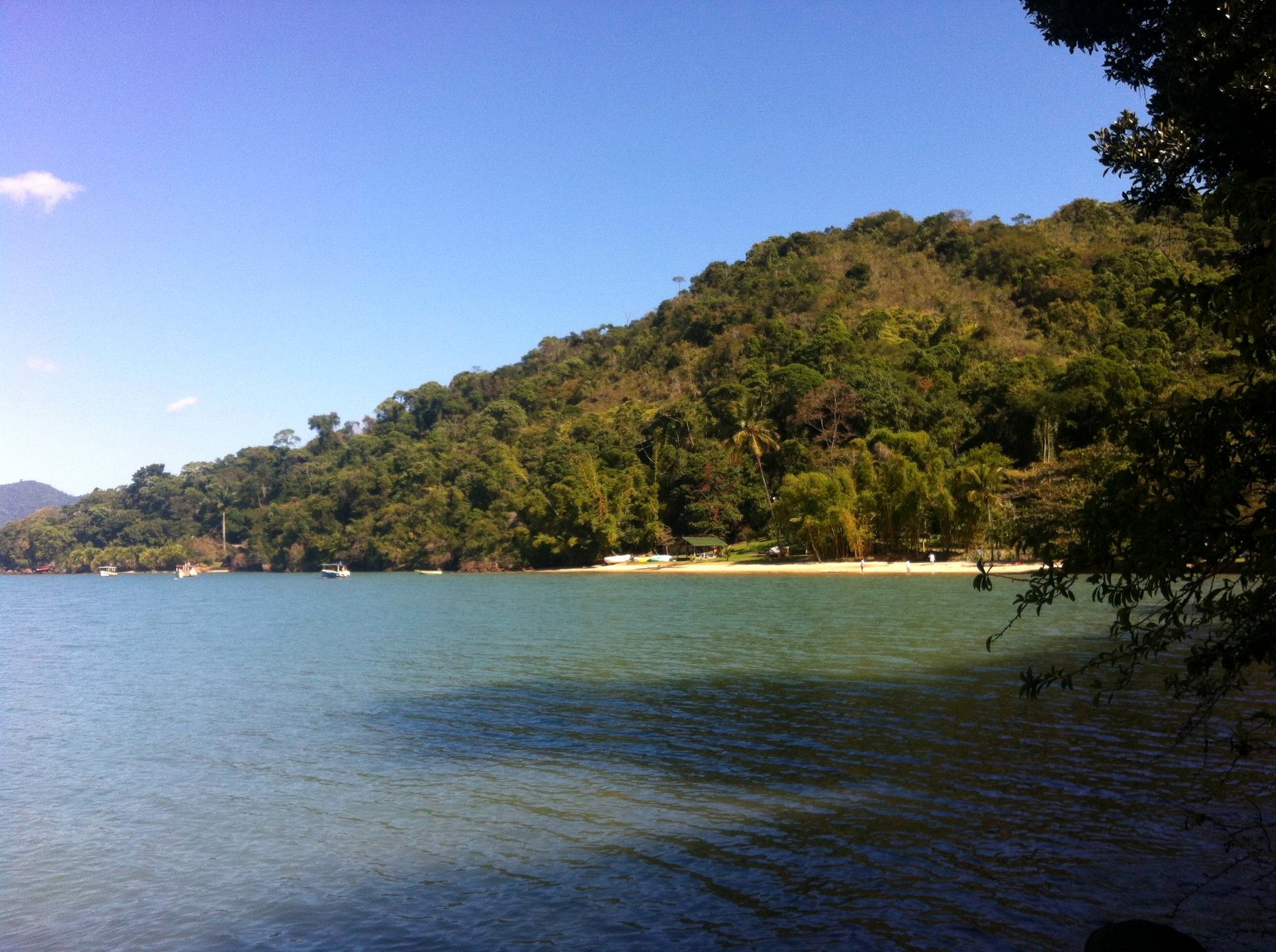
South of Paraty, the sea reaches inland for eight kilometers between two long, forest-covered ridges, forming a still, narrow arm of water unlike anywhere else on the Brazilian coast. This is Saco do Mamanguá, often called Brazil's only tropical fjord. Geologists will tell you it's technically a "ria" — a drowned river valley rather than a glacier-carved one — but the popular name has stuck for good reason: paddling into its calm, green length genuinely feels like slipping into a Scandinavian fjord that wandered into the tropics. It's the quietest, wildest, most singular piece of water around Paraty, and it rewards the small effort it takes to reach.
This guide covers what Mamanguá is, how to get there, what to do on and around the water, the communities who live there, and how to visit responsibly — because this is a protected area and a living place, not a theme park. If you're weighing it against a day on the open bay, our islands guide covers that side, and Paraty-Mirim — the usual gateway — has its own page.
In this guide
What Saco do Mamanguá is
Picture a long, narrow bay — roughly eight kilometers deep and up to about two kilometers wide — pushed inland between two mountain ridges thick with Atlantic Forest, at the mouth of the Rio Grande. That's Mamanguá. Along its shores are something like 33 small beaches, patches of mangrove, and a handful of traditional communities. The water is shallow and protected, so it stays glassy calm when the open sea is choppy — ideal for paddling — and the whole place has a hushed, end-of-the-road quality, because there is no road: you arrive by boat or on foot.
The "tropical fjord" label is the one thing worth getting right. A true fjord is carved by glaciers; Mamanguá is a ria, a coastal valley drowned by rising seas. Specialists make the distinction, and we'll honor it — but the reason everyone reaches for "fjord" is that the experience is exactly that: steep green walls, still water, and a long finger of sea reaching into the mountains. Call it what you like once you're floating in the middle of it.
How to get there
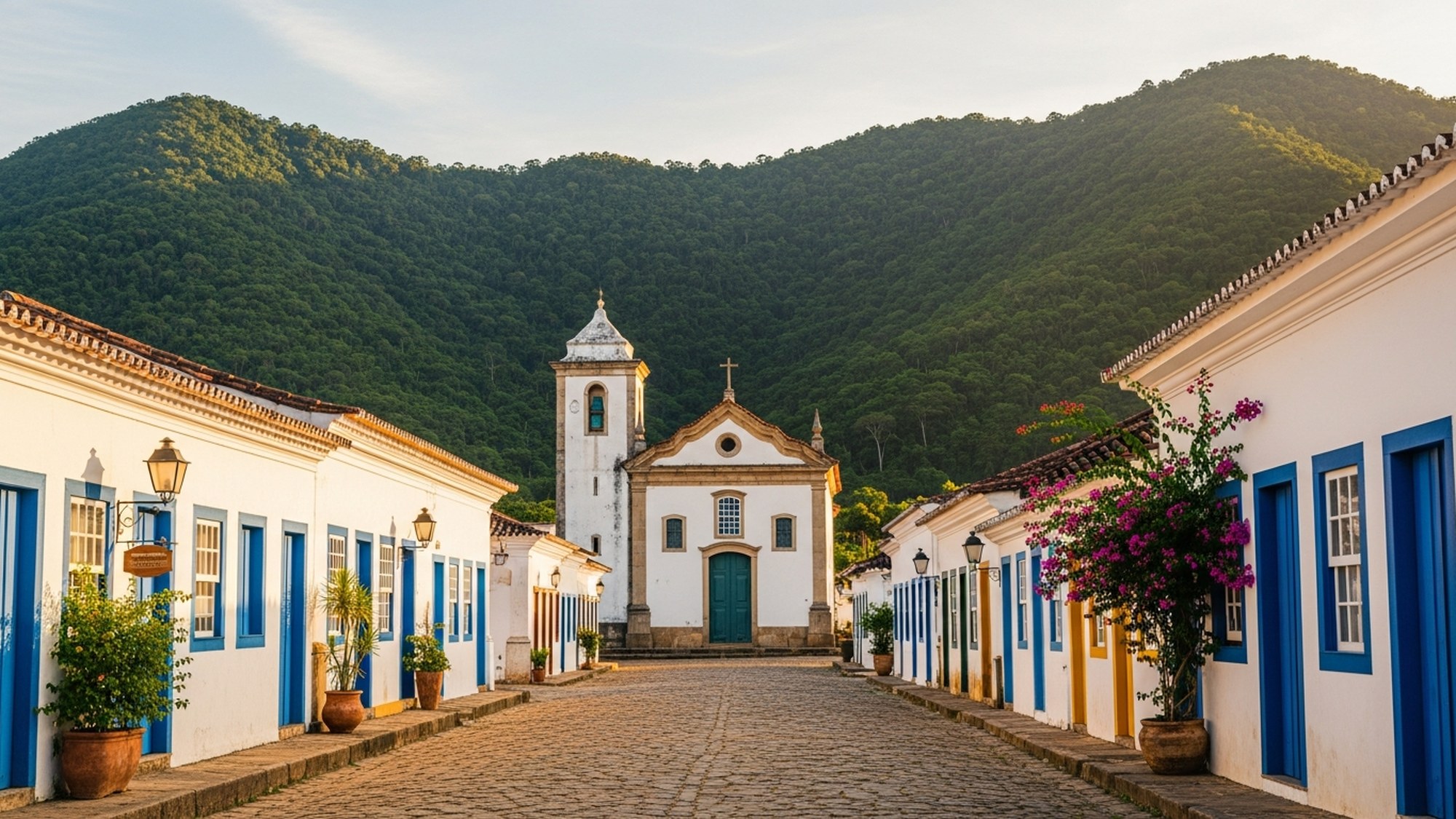
Mamanguá is reached from Paraty-Mirim, a small beach and old village about 15 to 18 kilometers south of Paraty (a roughly 30-minute drive, part of it on dirt road, or a local Colitur bus). From the pier at Paraty-Mirim, local caiçara boatmen run you into the fjord — a fast taxi-boat takes around 20 minutes, a slower wooden boat about 40. This is the standard, easy way in, and it's part of what keeps Mamanguá quiet: you can't just drive up to it.
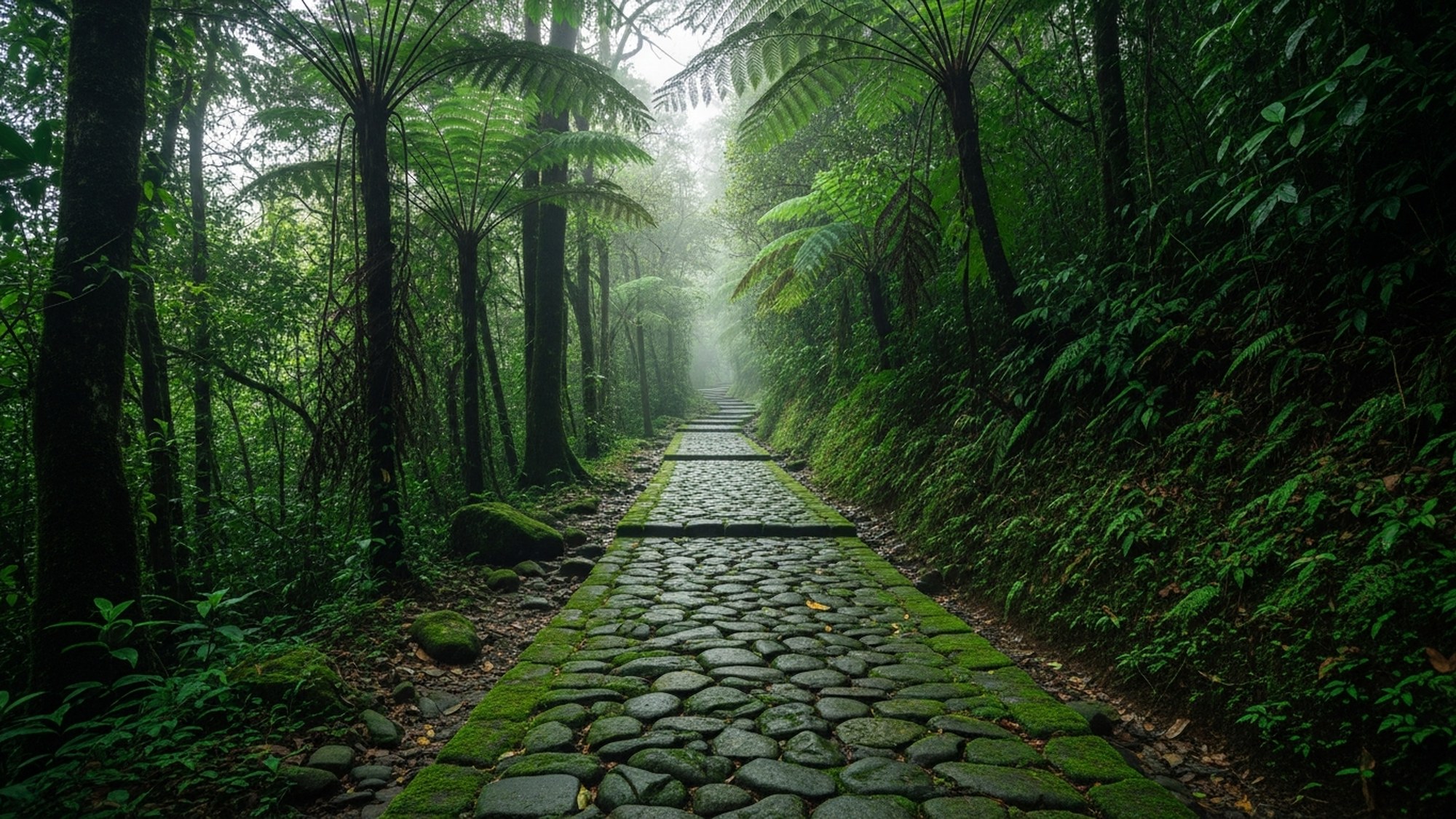
The more adventurous alternative is to walk in, on trails over the Juatinga peninsula (one common route takes around 90 minutes), or to make the whole journey by kayak or stand-up paddleboard from Paraty-Mirim, which turns the approach itself into the highlight. However you come, there's no road into the interior — the absence of one is the point. For the full picture of the gateway village, see our Paraty-Mirim guide.
Paddling & kayaking the fjord
Mamanguá is, above all, a paddling place. The sheltered water is tailor-made for stand-up paddleboard (SUP) and kayak, and gliding the length of the fjord — forest on both sides, herons in the shallows, the occasional oyster raft — is the classic Mamanguá experience. You can do a gentle half-day out and back, or, for the keen, multi-day kayak journeys that camp along the shore. The calm makes it accessible to reasonably fit beginners, not just athletes, though the full eight-kilometer length and back is a proper outing — pace it, carry water, and mind the sun, which is fierce off the water.
Beyond paddling, the shallow beaches are for swimming and simply doing nothing, and the whole area is a naturalist's pleasure — mangroves, seabirds, and the constant green wall of the Mata Atlântica. It's the antidote to a busy schooner day: slow, quiet, and self-propelled.
The climb up the Pico do Pão de Açúcar
The signature hike here is the Pico do Pão de Açúcar do Mamanguá — a pointed "sugarloaf" peak that stands over the mouth of the fjord and delivers one of the great views in the region: the whole inlet laid out below, the bay beyond, and the ridges running down to the sea. Accounts put its height at roughly 420 to 440 meters (sources vary between about 425 and 438), and the trail is short but steep — around 1.4 kilometers of climbing from the trailhead at Praia do Cruzeiro (itself reached by boat), taking most people an hour to an hour and a half up, largely through closed forest and often unsigned.
It's a moderate-to-strenuous walk rather than a casual stroll — proper shoes, water, an early start to beat the heat, and ideally a local guide, since the path isn't well marked. The reward at the top is worth every bit of the sweat. This ties into the wider trail network in our hiking and nature guide.
Oysters & the caiçara communities
Mamanguá is not empty. Around eight traditional caiçara communities — several hundred residents in total — live along its shores, and they've shaped what the fjord is. Their signature is oysters: the sheltered water is cultivated for oysters, and eating them fresh at a simple community restaurant, sometimes with your feet near the sand, is one of the real pleasures of a visit. Places in the communities around Praia do Cruzeiro and the Pontal are known for exactly this. These are working communities that only recently got mains electricity and keep a deliberately low-infrastructure life — part of what makes Mamanguá feel like somewhere time forgot.
Visiting well means supporting them: buy the oysters and the meal, hire the local boatmen and guides, and treat the place as someone's home, which it is. It's a better experience for it, and it keeps the money where it belongs.
Staying & camping
You can turn Mamanguá into an overnight rather than a day trip. There are rustic pousadas and camping along the shores — deliberately simple, often off-grid, with limited or no internet. Waking up to mist on the fjord and paddling before the day-trippers arrive is a special thing. Just go in with the right expectations: this is basic, back-to-nature lodging, not a resort, and that's exactly the appeal. Bring what you need, tread lightly, and enjoy the quiet.
A protected place — visiting responsibly
Saco do Mamanguá sits inside the federal Área de Proteção Ambiental de Cairuçu, which also contains the state Reserva Ecológica Estadual da Juatinga — a protected mosaic covering the forest, the water and the traditional communities. That status is why it's still so intact, and it comes with a simple responsibility for visitors:
- Keep clear of the oyster-cultivation lines and rafts when paddling or boating — they're someone's livelihood.
- Don't disturb the mangroves; they're the nursery of the whole system.
- Carry out everything you carry in. There's little infrastructure, so leave no trace.
- Hire local. Local boatmen, guides and kitchens both know the place best and are the ones its protection depends on.
Do that, and Mamanguá gives back one of the most peaceful days you can have on this coast. From Amorielli, it's an easy trip to arrange — the drive to Paraty-Mirim, a boat into the fjord, a paddle, oysters, and the climb if you're up for it.
Common questions
Is Saco do Mamanguá really a fjord?
It's often called Brazil's only tropical fjord, but geologically it's a ria — a coastal river valley drowned by rising seas — rather than a glacier-carved fjord. The experience, though, is very fjord-like: an eight-kilometer arm of calm water reaching inland between steep forested ridges.
How do you get to Saco do Mamanguá?
From Paraty-Mirim, about 15 to 18 kilometers south of Paraty. From the pier there, local boatmen run you in — around 20 minutes by fast boat, 40 by wooden boat. You can also walk in over the Juatinga peninsula trails or paddle in by kayak or SUP. There's no road into the fjord itself.
How hard is the Pico do Pão de Açúcar hike?
Moderate to strenuous. It's a short climb — about 1.4 kilometers from Praia do Cruzeiro — but steep, gaining roughly 420 to 440 meters, and it takes most people an hour to an hour and a half up. The trail is often unsigned, so a local guide, good shoes, water and an early start are all worth having.
What is there to do in Mamanguá?
Stand-up paddling and kayaking on the calm water, swimming off the quiet beaches, eating fresh local oysters at the caiçara community restaurants, hiking the Pico do Pão de Açúcar for the view, and simply doing nothing in one of the most peaceful settings on the coast. Rustic camping and pousadas let you stay overnight.
Can you eat oysters at Saco do Mamanguá?
Yes — the fjord's caiçara communities cultivate oysters, and eating them fresh at a simple community restaurant is a highlight. It also directly supports the people whose stewardship keeps Mamanguá intact.
More from the Journal
The Complete Guide to Paraty, Brazil
Everything you need for the Costa Verde's most beautiful town: the UNESCO old town, the waterfalls and trails, the islands and beaches, the cachaça, where to eat and stay, when to come — and exactly how to get here.
The Best Things to Do in Paraty, Brazil
The complete overview: the colonial old town and its churches, the Gold Trail, the waterfalls and cachaça road, the island bay and the tropical fjord, the beaches, and the festival calendar — everything worth doing, and how to fit it into three days or a week.
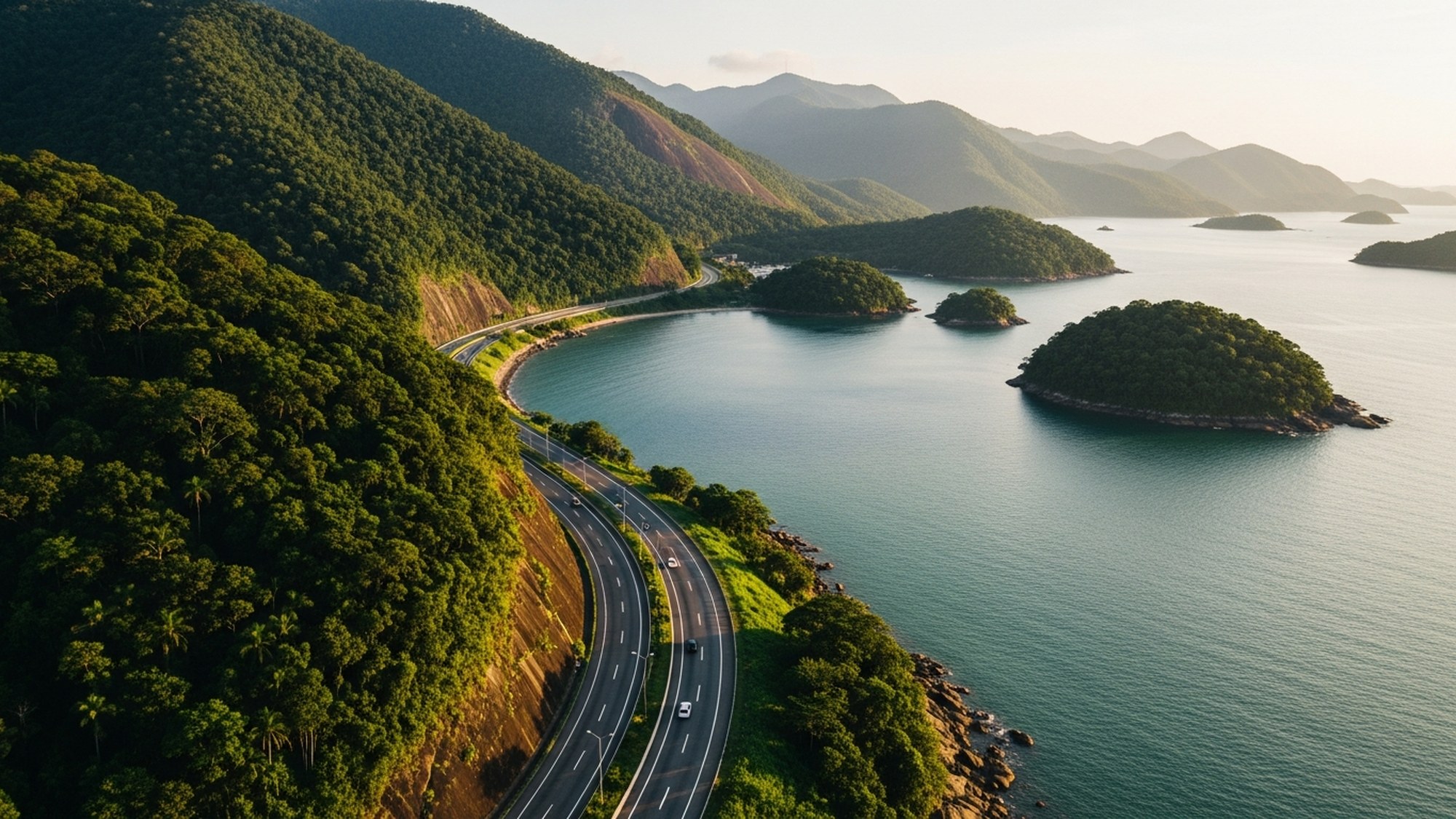
How to Get to Paraty: Airports, Transfers & the Drive from Rio
Which airport to fly into, how long the drive really takes, when to consider an air taxi into Paraty's own airstrip, and how to make the famous Rio-Santos coast road work for you instead of against you.
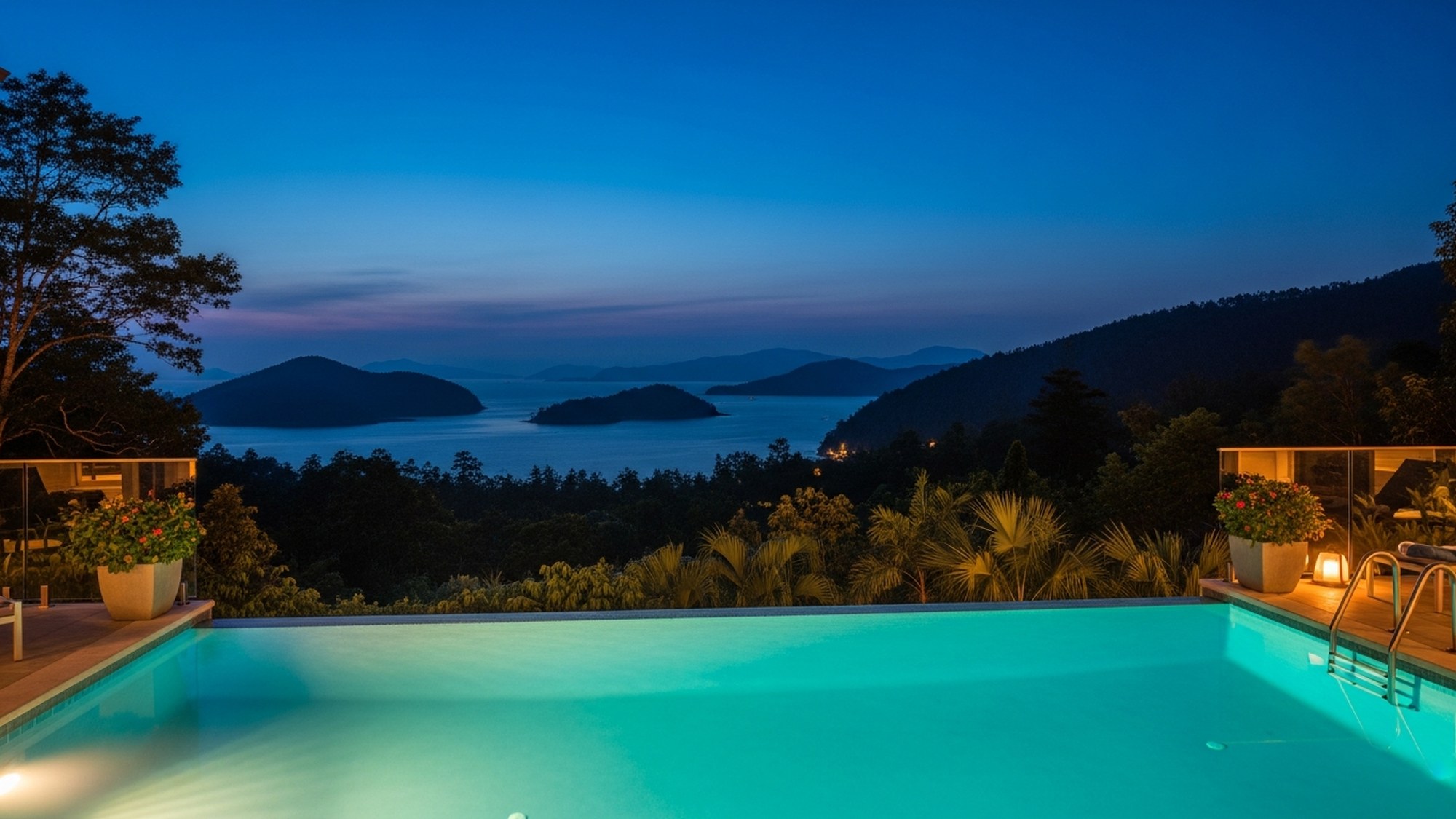
Stay at Amorielli.
A villa with an infinity pool, a private waterfall, and the kind of view people travel a long way to find. Join the waitlist to book the first season.